Contents
- Map Of The Hike To Beaver Falls
- The Hike To Beaver Falls Arizona (Havasupai Reservation)
- Ladders Along Havasu Creek To Beaver Falls
- Beaver Falls Hike: Distance And Difficulty
- Swimming At Beaver Falls
- The Best Time To Visit Beaver Falls (And All Havasupai Falls)
- Beyond Beaver Falls: The Grand Canyon & The Confluence With The Colorado River
- How To Get A Permit For Beaver Falls, Arizona (Havasupai)
- FAQ’s About Beaver Falls, Arizona (Havasupai Reservation)
- Wrap: Why We Love Beaver Falls Arizona (Havasupai)
HIKE TO BEAVER FALLS, ARIZONA (HAVASUPAI RESERVATION)
Beaver Falls in Arizona is an oasis in the Desert Southwest. It’s technically on the Havasupai Reservation, adjacent to the Grand Canyon.
Visiting Beaver Falls, and the other stunning waterfalls along Havasu Creek, requires a permit, overnight camping, and a lengthy hike through a desert canyon.
It’s all part of the adventure to Havasupai Falls!
KEY TAKEAWAYS
Beaver Falls gets overshadowed by the more majestic and “Insta-famous” Havasu Falls and Mooney Falls on the Havasupai Reservation. Still, it’s well worth a hike, and many visitors find it to be the most enjoyable spot along Havasu Creek to spend the day.
Map Of The Hike To Beaver Falls
I always recommend upgrading to the “Pro” version of the AllTrails app for a trip to Havasupai Falls.
There’s no cell reception during your hikes to the different waterfalls, but you’re able to access maps you’ve downloaded on the app the entire time. Plus, you’ll still be able to see your location as a “blue dot” as you hike along Havasu Creek through the canyon.
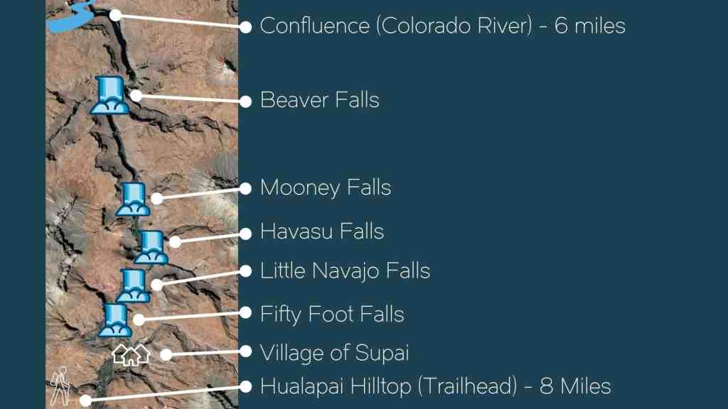
This map shows where Beaver Falls sits along Havasu Creek, as it flows from the village of Supai up toward the Colorado River:
The Hike To Beaver Falls Arizona (Havasupai Reservation)
Again, it’s almost unbelievable to find such a green, lush area in this part of Arizona, right near the Grand Canyon. You’ll love the trail from the Havasupai Falls Campground down Havasu Creek to Beaver Falls…. once you get beyond the climb down Mooney Falls.
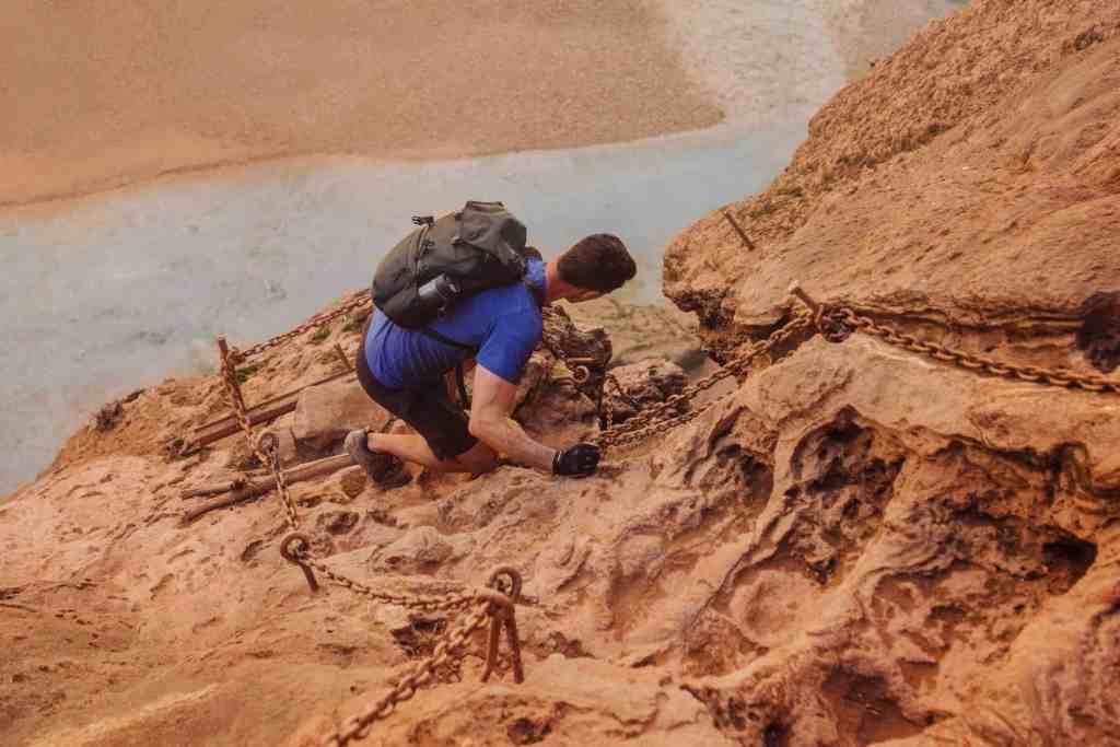
First, You’ll Have To Climb Down Mooney Falls
I suppose some people love the descent down Mooney Falls and get “a rush” from the vertical climb down the sheer rock wall. It’s more than a 200-foot drop to get from the campground at the top down to the blue water in the pool below the waterfall.
Mooney Falls is named after a miner who died trying to save a fellow injured miner, by trying to scale the rock wall with the man on his back.
A few years later, some who were part of the same mining company blasted holes in the rocks to form tunnels which you’ll still use to this day in part of the descent. The tunnels aren’t long, and once inside you can almost immediately see the light on the other end.
After the tunnels, things get more nerve-wracking for people who don’t like heights. It’s a vertical drop down the rest of the way. A series of chains, precariously secured into the rocks, will help you climb down slowly. There are chunks in the rock wall for you to use as steps.
Eventually, your feet will hit the wooden ladder near the bottom. From here, the rest of the climb down becomes easy (and less dangerous).
In addition to conquering any fears of heights, you’ll also be hit with mist from the waterfall the entire way down Mooney Falls. It might be refreshing on a hot summer day, or bone-chilling on a cool day in the early spring.
Thankfully, there’s no moss or anything slippery growing on the rocks or the ladders here.
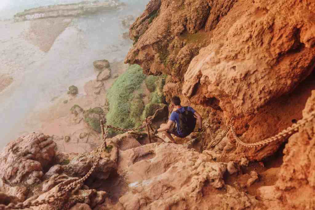
Havasu Creek Crossings
Once you make it to the bottom of Mooney Falls, the hard part is over! Again, I know some people love rock climbing and vertical drops. I’m not one of them, so at least *for me* the hard part was over!
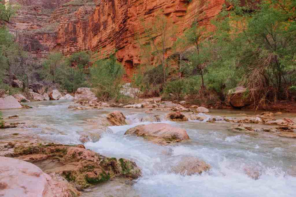
From there, you’ll follow Havasu Creek for three miles to Beaver Falls.
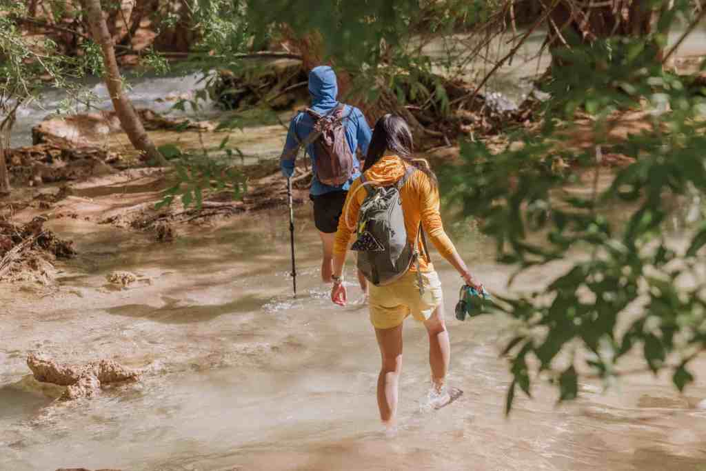
The trail to the falls will cross the creek three times. The first crossing is about a third of a mile in.
The water is usually knee-deep or waist-deep, depending on the creek’s flow and the hiker’s height.
Thankfully, the rocks you’re walking on aren’t slick at all. There’s not much moss or algae growing on the creekbed at Havasu, so you’ll have an easy time on the crossings.
How you choose to handle the crossings when it comes to footwear is up to you. There’s no “right” answer.
I changed shoes at every crossing, alternating between dry hiking boots and wet water shoes. It’s not ideal, and it becomes tedious to have to dry your feet off and change shoes several times on your hike in … and again on your hike out.
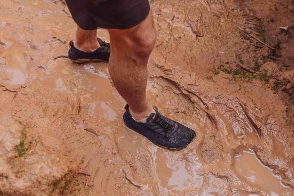
Some people just wore water shoes with hiking treads on the bottom. Some people wore hiking sandals the whole way.
I’d choose the option you think will leave your feet least-prone to blistering!
The Trail To Beaver Falls
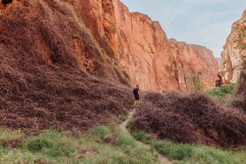
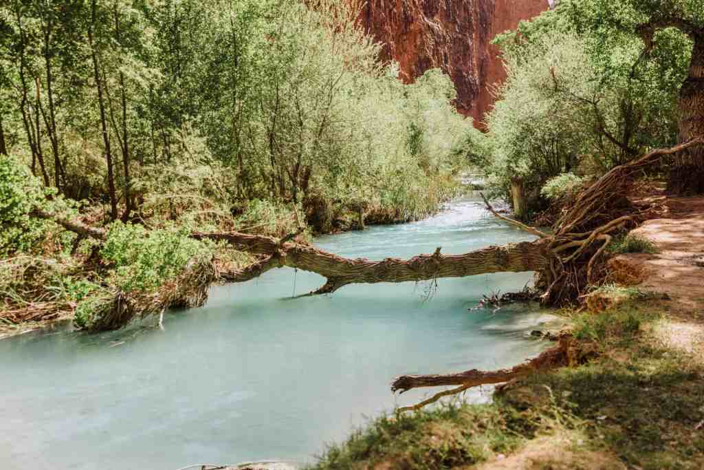
Aside from the creek crossings, the trail to Beaver Falls is beautiful. I kept thinking, “I can’t believe this is in the Arizona desert!”
The trail includes sandy stretches that go through meadows, which bloom with wildflowers in the spring.
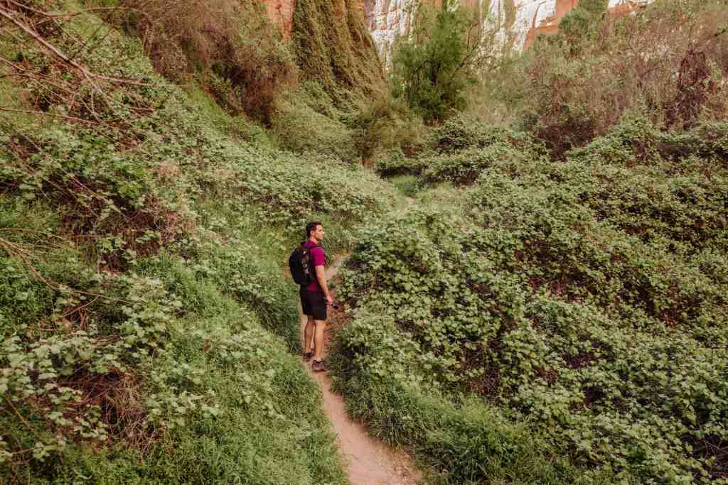
In other parts, you’ll wind through mounds of grapevines on either side of the trail. You’ll also hike by a few picnic tables if you feel like relaxing and having a snack.
Later in the hike, you’ll have to scramble up rocks and eventually down a steep descent to get to the falls.
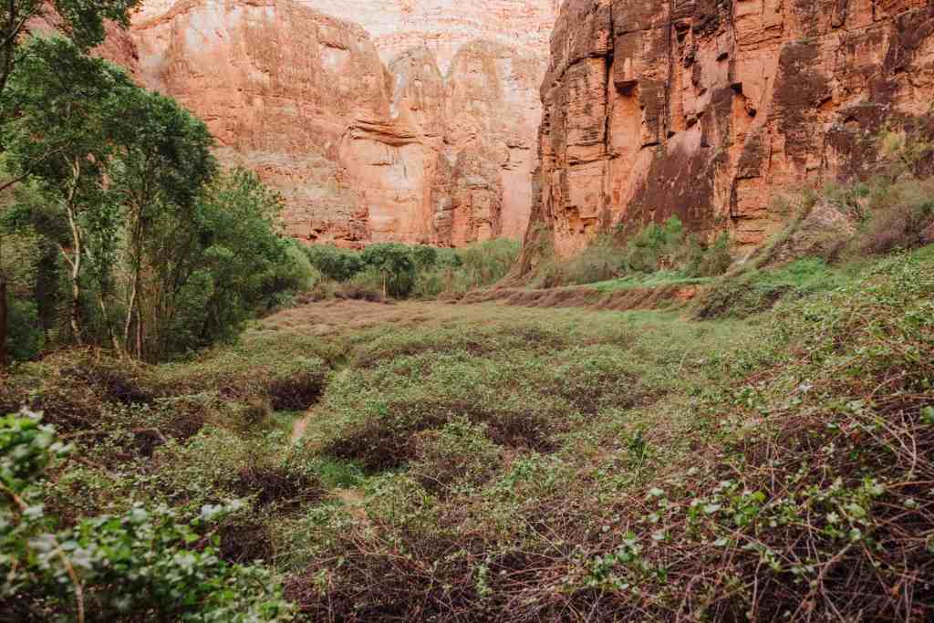
You’ll hike by several other waterfalls, which look like smaller versions of Beaver Falls. They’re also great spots for swimming or picnics.
Your first visual of Beaver Falls will be from a cliff above.
Wildlife Encounters: Big-Horned Sheep At Beaver Falls
You’re also likely to see desert big-horned sheep on your hike back to the campground!
I’d heard about the sheep in the area, but wasn’t sure we’d get lucky enough to see them.
Sure enough, two days in a row, as the sun started to drop below the canyon walls, the sheep climbed down for dinner.
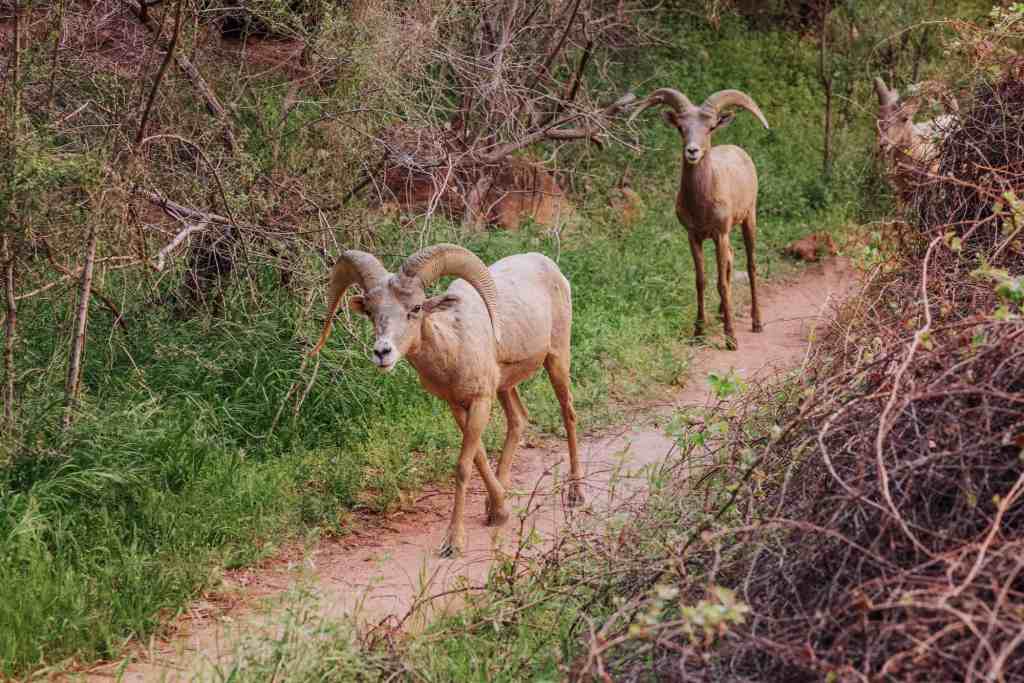
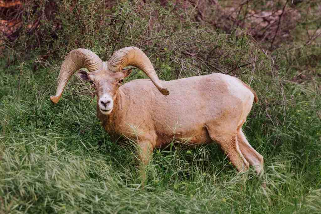
They seemed used to seeing hikers passing by, and didn’t run off. The male (or males) sort of “stood watch” as we got closer to them on the trail, and continued eating after we moved on.
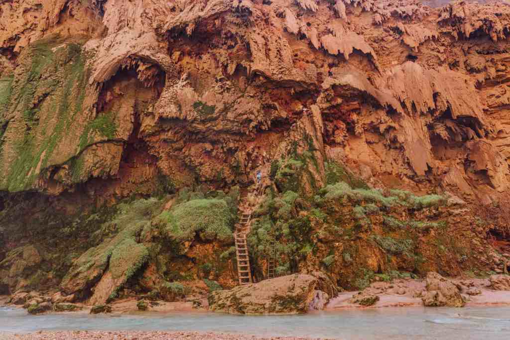
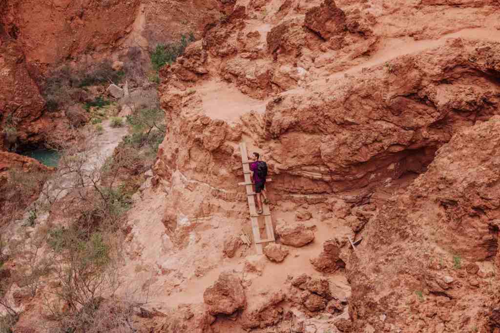
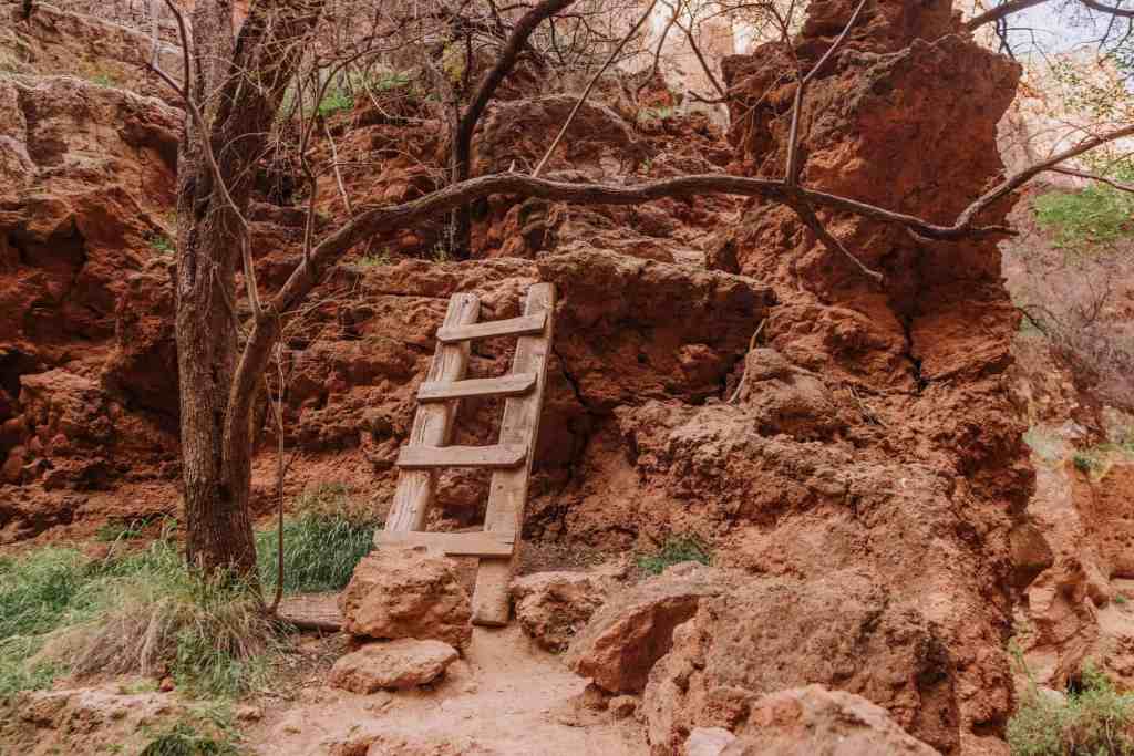
Ladders Along Havasu Creek To Beaver Falls
Ladders along Havasu Creek change over time, as seasonal floods come through and wash them out. It happens every year or two. Sometimes, it happens more than once in a 12-month span!
Flash floods hit in October of 2022, and then again in March of 2023, forcing the Havasupai Tribe to rebuild and replace the ladders along Havasu Creek between the village of Supai and Beaver Falls.
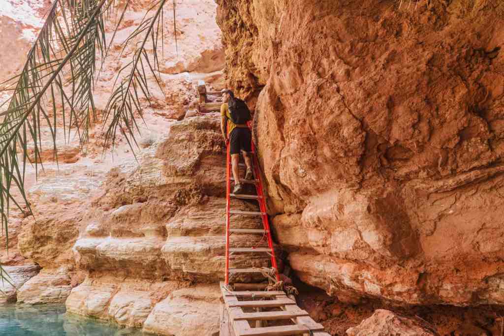
A traditionally wooden ladder on the hike to Beaver Falls is now replaced with an aluminum ladder, tied to the rocks. It arrived as part of the latest round of FEMA disaster relief the tribe received.
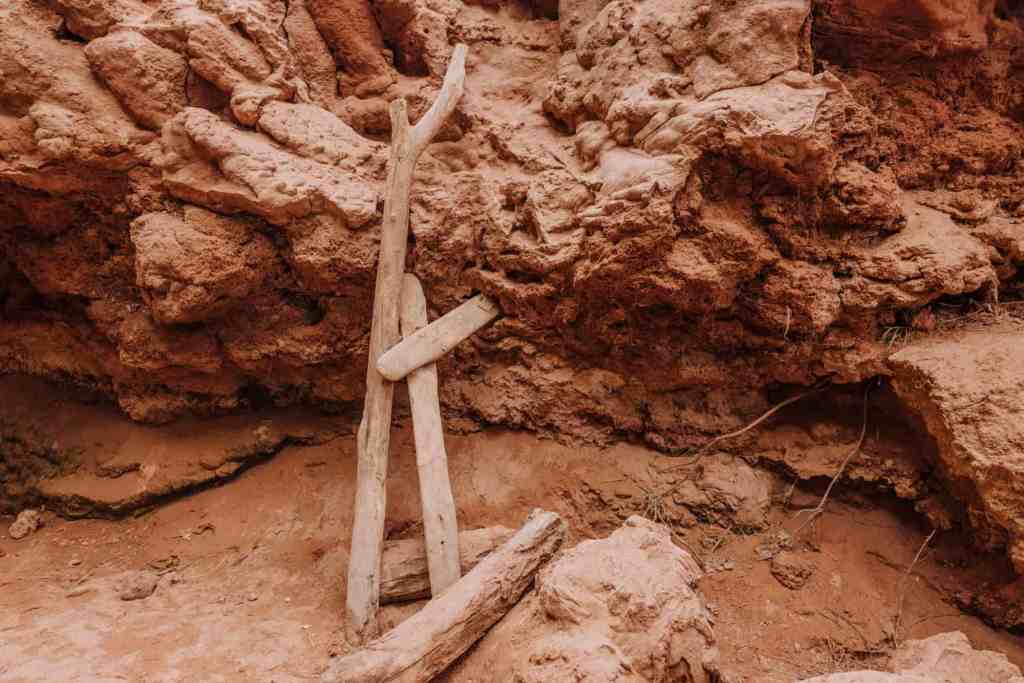
Right at the end of the hike to Beaver Falls, you’ll rely on a few older, wooden ladders (and structures that resemble ladders) for the final descent.
Beaver Falls Hike: Distance And Difficulty
Hikers might find a couple of spots challenging on the way to Beaver Falls. Really, once you get beyond the chains and ladders at Mooney Falls, the rest of the three miles to Beaver is very enjoyable and not very difficult.
While some of the ladders are makeshift, like the one below, they’ll help give you the boost you need up the rocks!
How Long Is The Hike To Beaver Falls?
Moving at a decent pace, you’ll make it to Beaver Falls in an hour. The big unknown is: how long will it take you to get down Mooney Falls? Sometimes there’s a long wait, since it’s single file. Generally, from the bottom of Mooney Falls to Beaver Falls is about an hour-long hike.
You’ll see varying estimates, but the consensus is: Beaver Falls is almost three miles from Mooney Fall, which is at the end of the Havasupai Campground. So it’s pretty safe to say: From your campsite at Havasupai Falls, expect a three-mile hike to Beaver Falls.
Other distances between the sites on the Havasupai Reservation:
- Supai Village to Little Navajo Falls: 1 mile
- Supai Village to Havasu Falls: 2 miles
- Supai Village to Havasupai Falls Campground: 2 miles
- Havasu Falls to Mooney Falls: 0.7 mile
- Length of the Havasupai Falls Campground: 0.7 mile
- Mooney Falls to Beaver Falls: 3 miles
- Beaver Falls to Confluence (Colorado River): 5.5 miles
How Difficult Is The Hike To Beaver Falls?
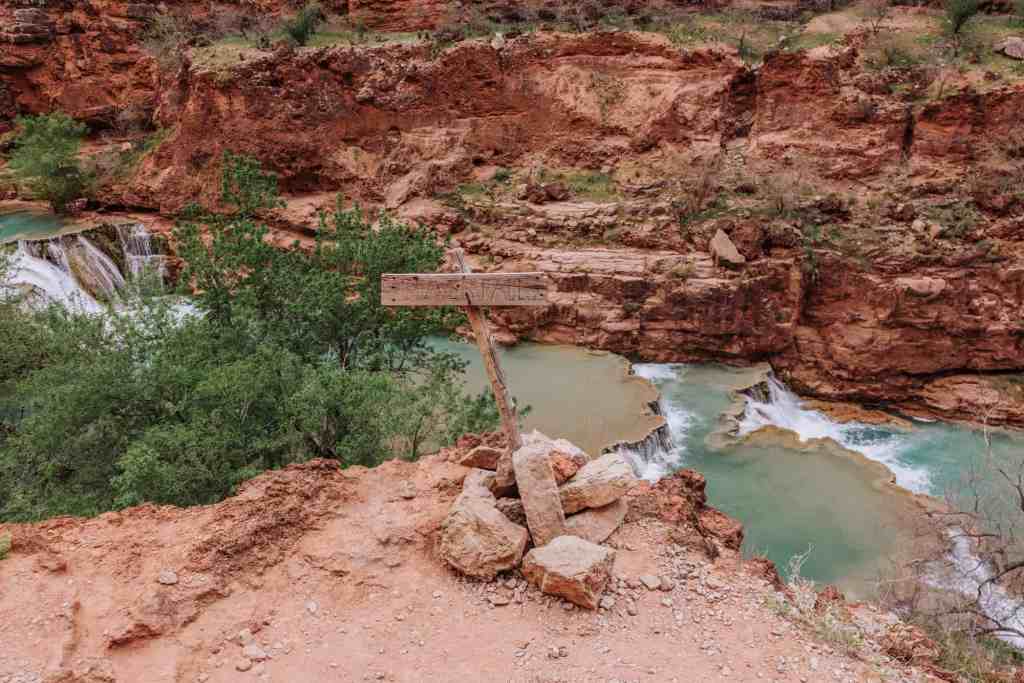
While the main trail will branch off from time to time, it’s impossible to get lost on a hike to Beaver Falls since you’re literally following Havasu Creek all the way there.
After the chains and ladders you’ll use to get down Mooney Falls, the rest of the trail is beautiful and relatively flat. I mentioned the few ladders you’ll have to climb both along the trail, and then to get down to Beaver Falls themselves.
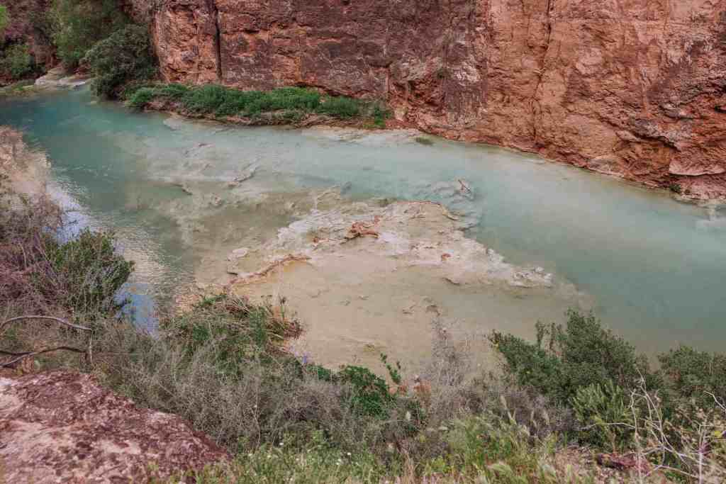
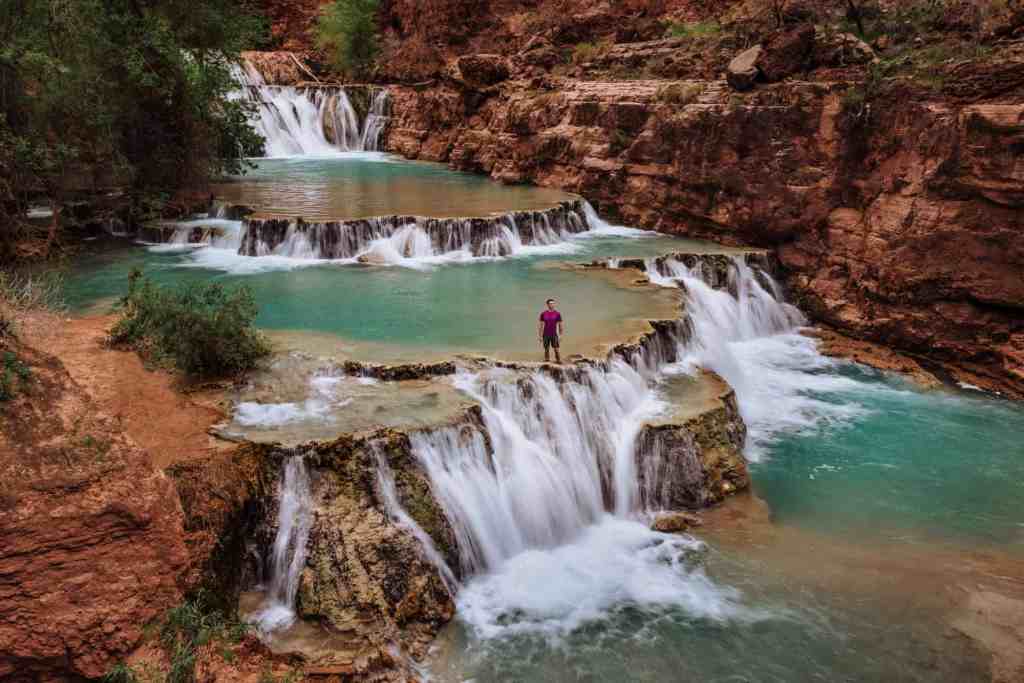
Swimming At Beaver Falls
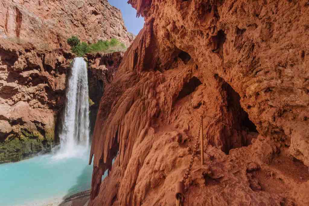
You can swim at Beaver Falls! It’s much easier (and safer) than swimming at Mooney Falls, where the undertow and current can be quite strong.
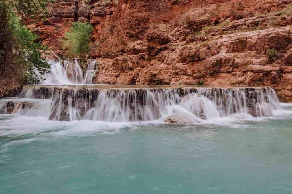
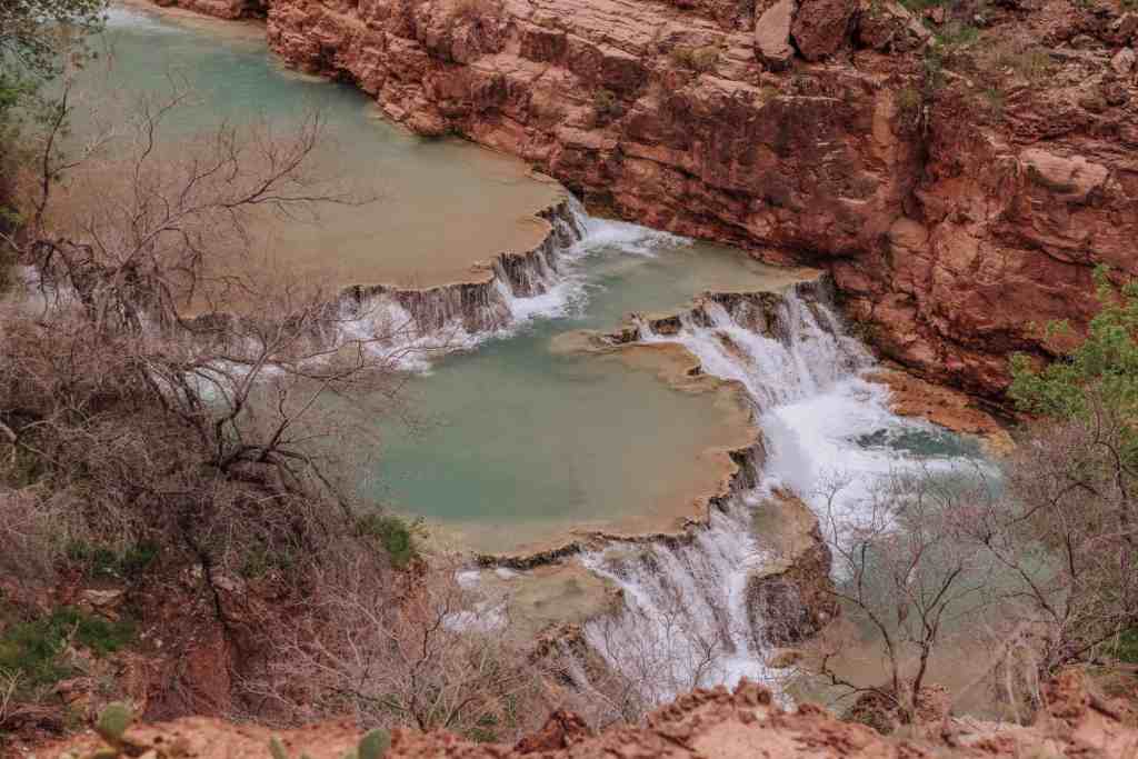
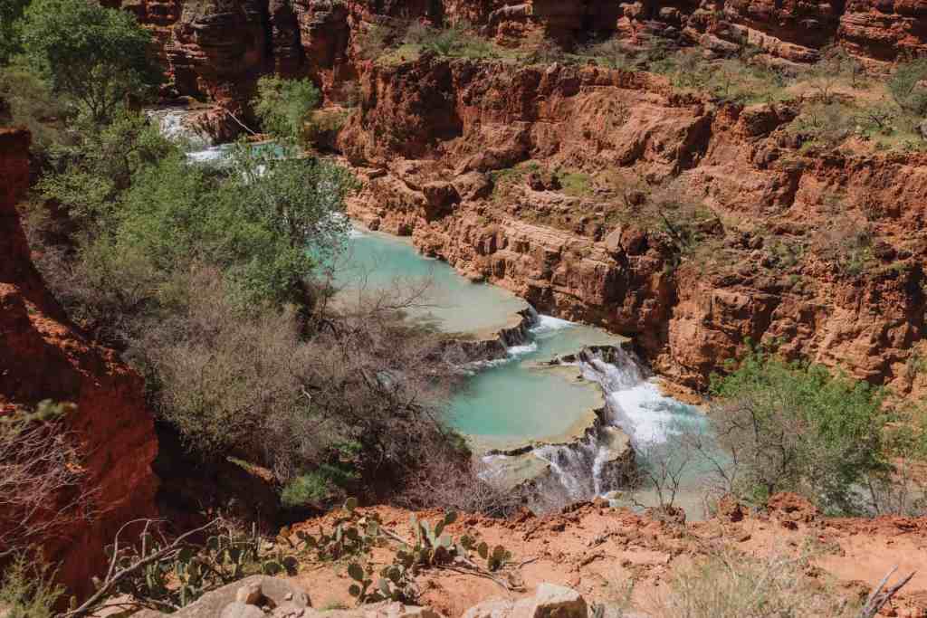
Beaver Falls is made of a series of cascading pools, which are very nice to wade through and lounge in.
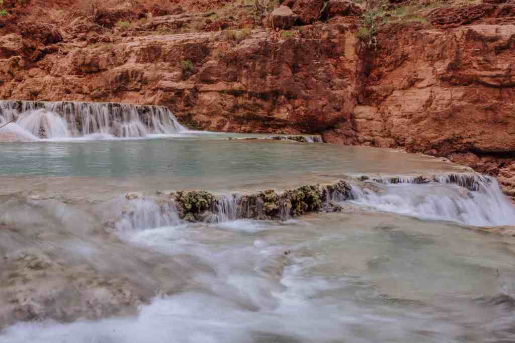
It’s one of the best spots to enjoy the blue waters of Havasu Creek!
Because the swimming holes at Beaver Falls are surrounded by canyon walls, the sun disappears in the afternoon. Most swimmers tend to leave after the sun drops. Chances are, depending on the time of the year, you’ll be the only people there by late afternoon!
What Creates The Beautiful Travertine Waterfalls And Pools?
Beaver Falls (and the similar smaller waterfalls in this part of Havasu Creek) are created by travertine shelves or terraces.
You’ll see the same formations in the Havasupai Falls Campground, too. In fact, I chose our campsite because it had a view of the terraces which I found especially pretty.
The Havasupai Tribe says high concentrations of lime in the water help build the natural travertine terraces over time.
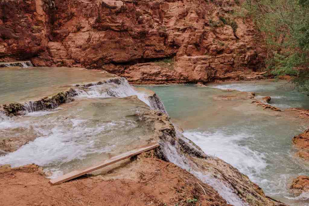
If you look closely, you’ll see rocks and twigs in the shelves at Beaver Falls, which get trapped in the lime and help build the structure. In one spot, you’ll see an entire tree trunk that helped form one of the main pools at Beaver Falls.
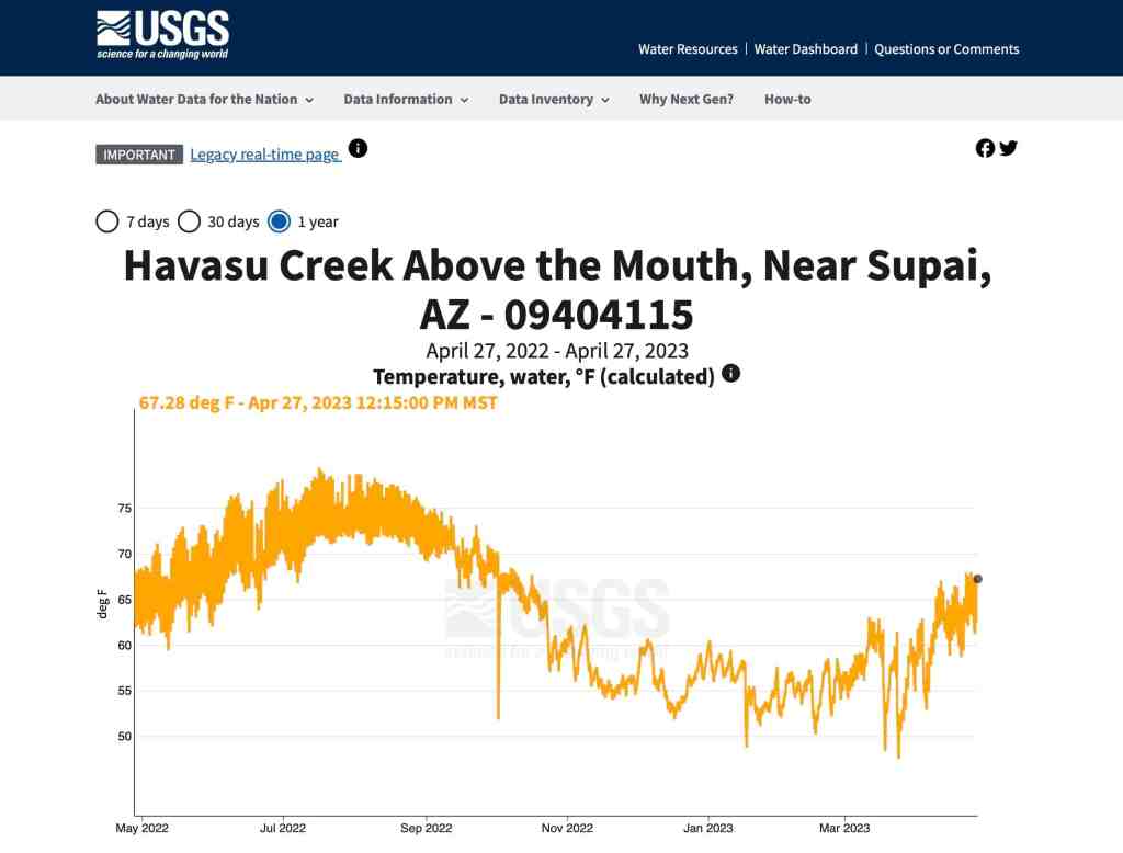
The Water Temperature At Beaver Falls (Havasu Creek)
Contrary to what many blogs post about the water temperature in Havasu Creek, it is *not always 70 degrees.
In the summer months, the water temperature at Beaver Falls will be up into the 70-to-75 degree range. It fluctuates by a few degrees each day.
In the spring and fall, the water temperature of Havasu Creek is in the 60s, and it drops down into the 50s during the winter.
The US Geological Survey has a temperature gauge, keeping track of Havasu Creek several times each day.
Here’s how the temperature averages layout over the course of a year:
What To Pack For A Visit To Beaver Falls
In addition to your own personal choice when it comes to hiking boots, water shoes and sandals, here are a few other things to make sure to bring in your day bag on a hike to Beaver Falls.
- SPF for your face and body. I used a new Neutrogena product on my face for this trip, which I like a lot. It provides broad-spectrum coverage and an SPF of 60, but it’s invisible. Your face won’t have that weird milky white residue. I also like their roll-on stick option for my arms.
- Gloves for climbing down the chains and rocks at Mooney Falls
- Plastic hiking bag for your wet shoes
- Quick-dry towel for the creek crossings
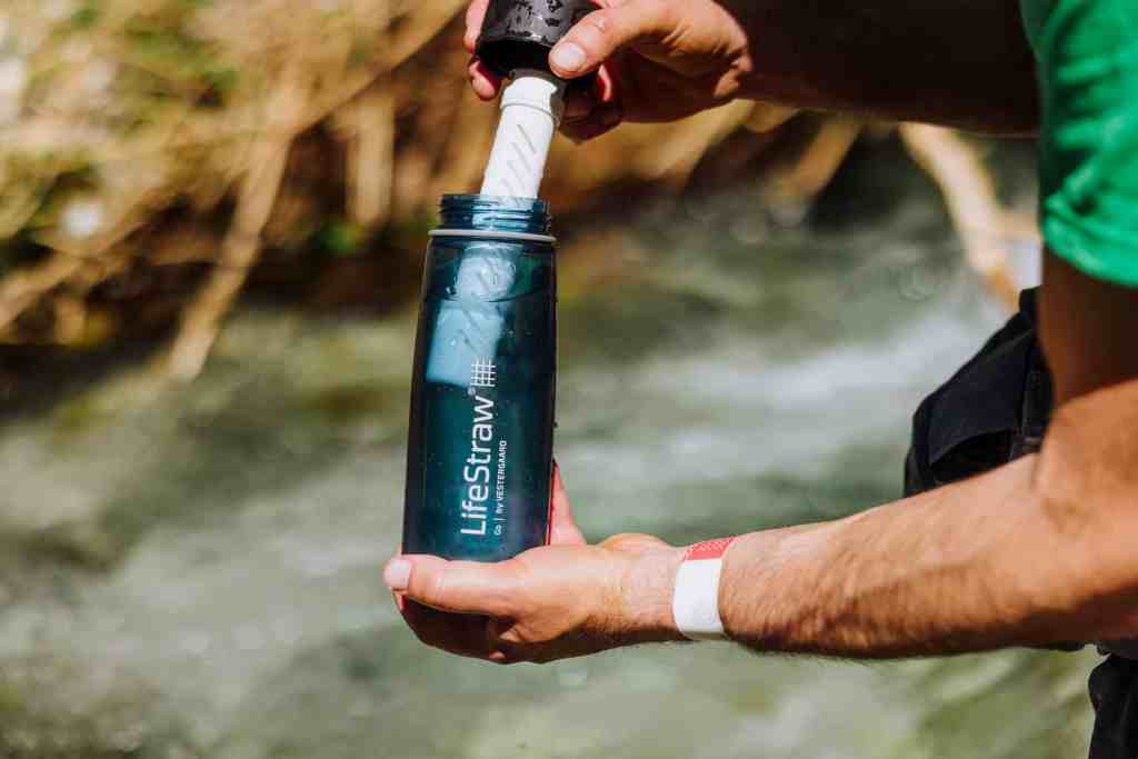
- Life Straw water bottle (MVP of the trip) so you can safely drink the creek water
- Foot Glide (a last-minute purchase, which spared my feet from blistering)
- Headlamp (just in case the sun sets and you have to climb Mooney Falls in the dark)

Photography Tips For Beaver Falls
While most people come to enjoy a sunny day at Beaver Falls, photography is easier after the sun drops. It gives you much nicer, even lighting for your photos while still picking up the bright blue tones in Havasu Creek.
You can also use the “live” photo option on an iPhone to get the effect of a smooth, time-lapsed waterfall. After taking a “live” photo, open the photo. On the top left of the screen, click the drop-down “live” menu and hit “long exposure.” It’s a fun trick to play around with at all of the Havasupai Falls!
The Best Time To Visit Beaver Falls (And All Havasupai Falls)
The best time to visit Beaver Falls is mid-April through June.
That’s my opinion, and it may not be best for you.
Here’s my reasoning:
I don’t like camping in the cold, and while temperatures can still dip into the 30s at night at Havasupai in April, it warms up nicely during the day.
The water temperature becomes more bearable in April and downright refreshing by the hotter days in May and June.
Even though Arizona temperatures climb into the triple digits in June, you’ll find plenty of shade along your hikes around Havasupai Falls to keep cool.
Monsoon season sets in from July through September, so you run the risk of flooding possible impacting your trip. It’s impossible to predict.
With all that said, if someone had a spare permit and invited me along in August or September, I’d jump at the chance!
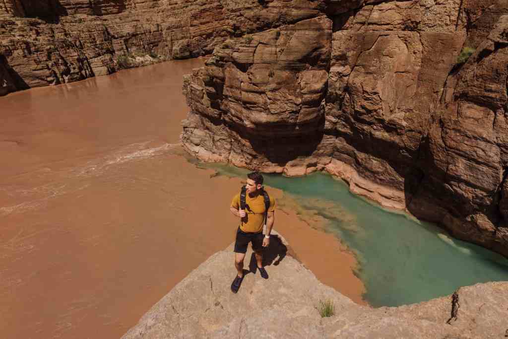
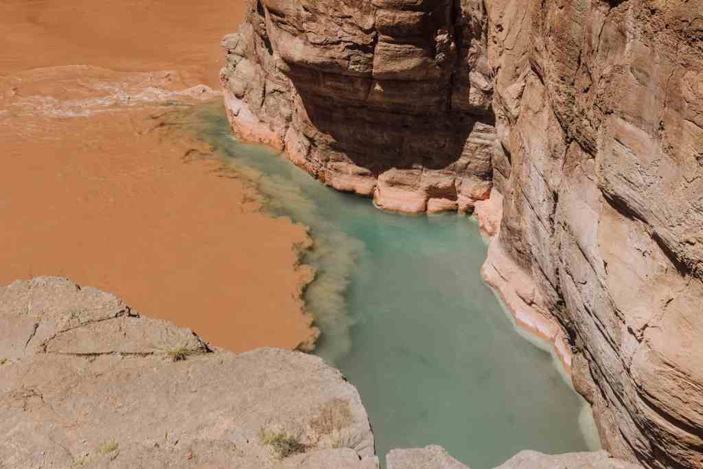
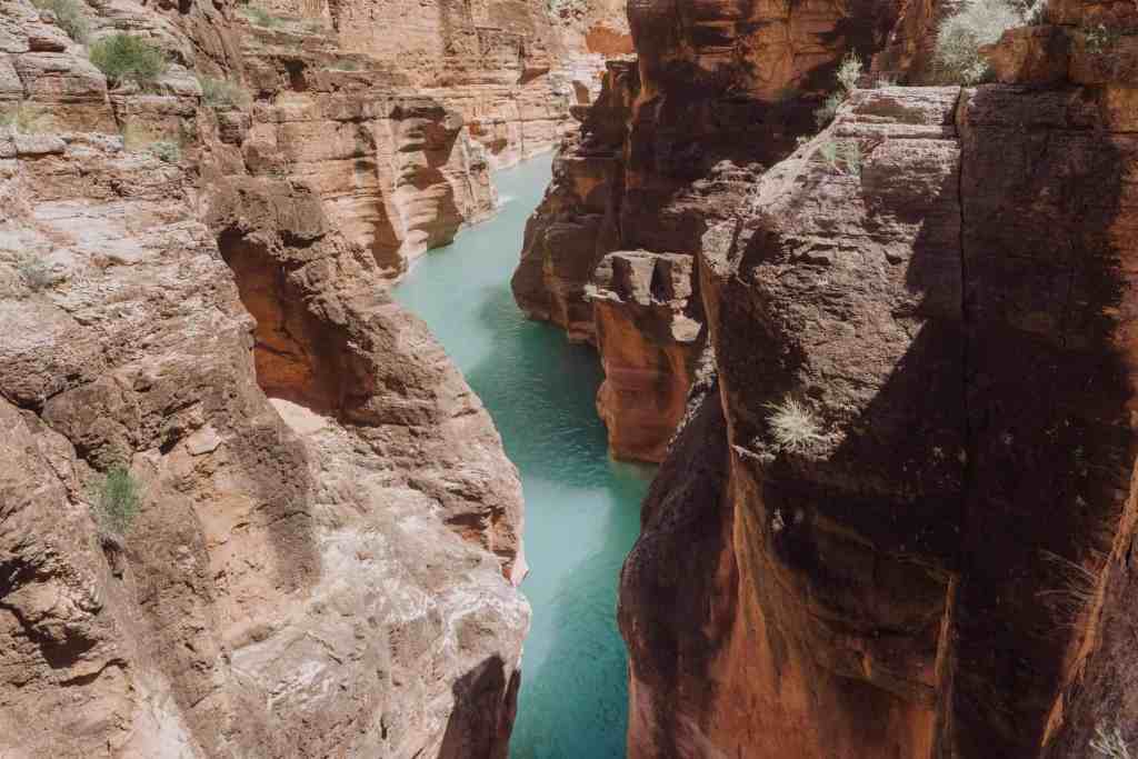
Beyond Beaver Falls: The Grand Canyon & The Confluence With The Colorado River
For Havasupai Falls visitors who want to hike to the confluence, where Havasu Creek meets the Colorado River, the advice from the Havasupai Tribe is to leave the Beaver Falls area no later than 10:30am.
The confluence is another six-miles (or so) from Beaver Falls.
It’s a full-day adventure, and you’ll need the time, especially in the spring and fall when the sun sets earlier.
While far fewer people make the trek to the confluence, choosing instead to spend more time enjoying Mooney and Beaver Falls, it’s a beautiful hike down the canyon. Plus, it’s interesting to see the turquoise water in Havasu Creek mix with the brown water of the Colorado River as it flows through the Grand Canyon.
Our trip to the confluence from Beaver Falls began at 10:30am, and we were back around 5:30pm. We took our time, swimming in the canyon and relaxing along the way.
You’ll cross Havasu Creek at least seven times between the start of your hike at Mooney Falls and the point where Havasu Creek hits the Colorado River.
Keep in mind: Beaver Falls is still three miles from the campground. The entire hike to the confluence is roughly a 17-18 mile round trip!
How To Get A Permit For Beaver Falls, Arizona (Havasupai)
Now for the boring, but necessary part. The permit is a hassle. You might wait years for it!

The Havasupai Tribe restricts the number of visitors allowed to the campground and waterfalls, to keep the place from becoming over-run and trashed.
Permits for 2023 are all taken, but some people who reserved them pre-pandemic are now finding: they don’t want to make the trip or can no longer make the trip to Havasupai Falls. Those cancelations are posted each morning at 8:00am on the official Havasupai Tribe’s Tourism website. They tend to be snatched up within a few minutes.
For 2024 permits to Havasupai Falls, you’ll have to wait for February 1st, which is when the Havasupai Tribe traditionally opens reservations for the entire year.
While the Tribe doesn’t publish official numbers, they allow roughly 100 permits a day, which amounts to around 30,000 per year. Havasupai Falls is usually closed to visitors in December and January.
The cost of a permit to visit Havasupai Falls is now up near $400. It’s a dramatic increase for people who last came in the 2000s and paid $35.
The Tribe cites the expense of hauling out garbage, repairing bridges and trails, and other factors as reasons for the increase in cost to visit Havasupai Falls. Without roads, the Tribe often has to fly loads of garbage out of the campground, at great expense.


For me, when I think of a cost of a trip to a place like Disney World, the added expense for a trip to Havasupai Falls is well worth it!
FAQ’s About Beaver Falls, Arizona (Havasupai Reservation)
Let’s knock out a few more frequently asked questions for future hikers at Beaver Falls!
When Did Beaver Falls Reopen?
After a three-year pandemic closure, the Havasupai Tribe reopened Beaver Falls (and all of the waterfalls along Havasu Creek) in February of 2023.
Can You Drive To Beaver Falls, Arizona?
No. There are no roads to Supai. The “easiest” way to get to Beaver Falls is a helicopter from the Hualapai Hilltop (Havasupai Trailhead) to the Village of Supai. From there, it’s a two-mile hike down to the campground, and another three-mile hike to Beaver Falls along Havasu Creek.
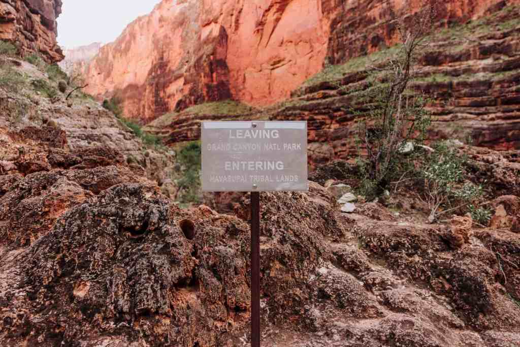
Is Beaver Falls In The Grand Canyon?
Technically… sort of…
The satellite view shows: the canyon you’ll hike to get to Havasupai Falls is part of the large canyon system which includes the Grand Canyon.
Beaver Falls is on tribal land, belonging to the Havasupai Reservation, so it’s not within the boundaries of Grand Canyon National Park.
If you choose to hike beyond Beaver Falls to the Colorado River, you’ll pass the official dividing line between the Havasupai Reservation and the national park.
So, people on a long rafting trip through the Grand Canyon are technically not supposed to make the hike up to Beaver Falls. It would be considered trespassing on tribal land without the proper permit. In fact, there’s a sign warning against it on the trail:
Wrap: Why We Love Beaver Falls Arizona (Havasupai)
While the main trail to Beaver Falls will branch off from time to time, it’s impossible to get lost on your hike there since you’re following Havasu Creek the whole way.
A lot of visitors to Havasupai Falls are lured there by the impressive bigger waterfalls: Mooney Falls and Havasu Falls. But many leave with fonder memories of the day they spent at the less dramatic, but just-as-beautiful terraced pools that make up Beaver Falls.