![]()
![]()

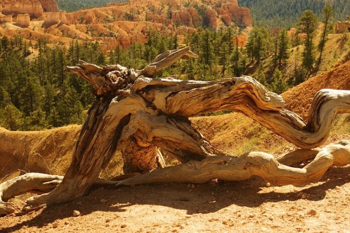
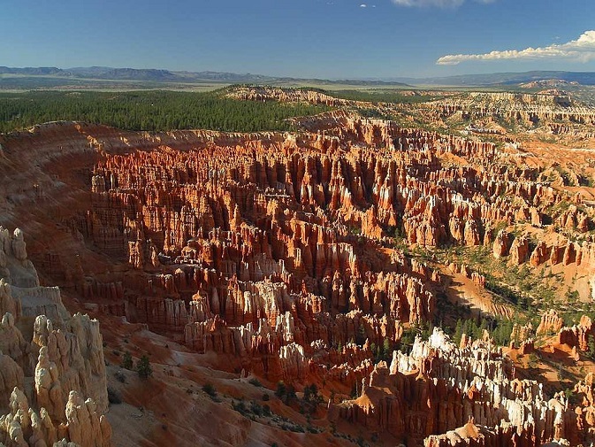
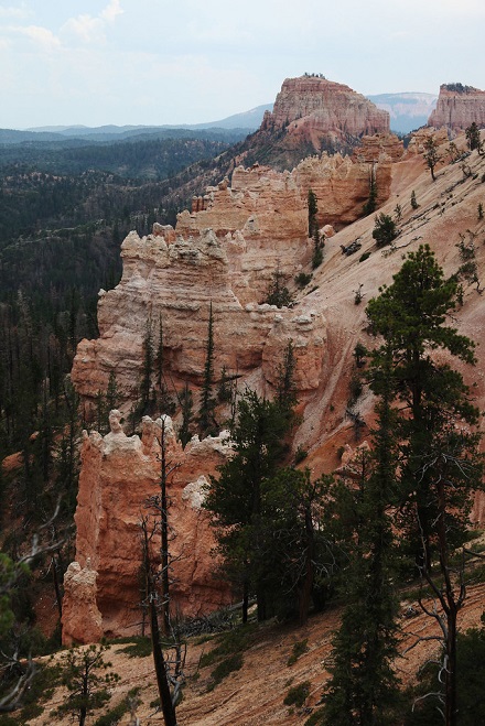
Bryce Canyon National Park in the US state of Utah features a landscape said by some hikers to be enticing. The gorgeous glowing gold and orange hoodoos and dramatic landscape make it a must-see location. To help determine how to explore this popular place, here are the top 11 top-rated hikes in Bryce Canyon National Park.
Contents
- 1. The Queen’s Garden And Navajo Loop Combination Trail
- 2. The Sunset Point To Sunrise Point Hike
- 3. The Fairyland Loop Hike
- 4. The Peek-A-Boo Loop Trail
- 5. The Queen’s Garden Trail
- 6. The Navajo Trail
- 7. The Bristlecone Pines Hike
- 8. The Tower Bridge Hike
- 9. The Hike To Mossy Cave
- 10. The Hat Shop Hike
- 11. The Sheep Creek And Swamp Canyon Hike
The 11 Top-Rated Hikes In Bryce Canyon National Park

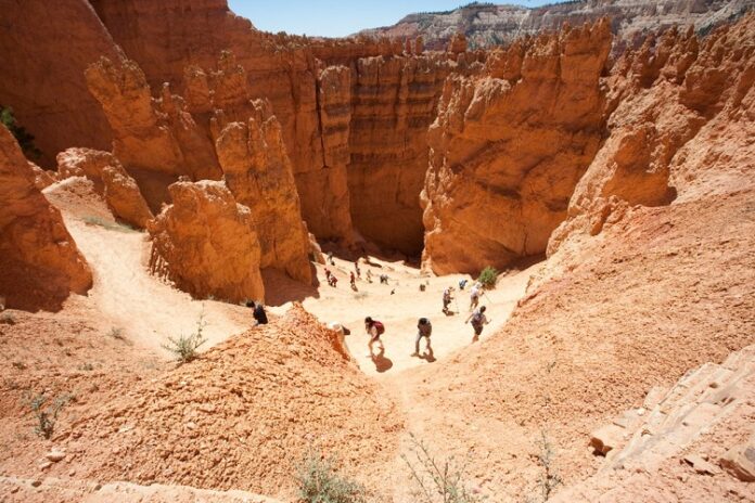
This loop trail is rated as moderately difficult due perhaps to its 600-foot elevation and length of almost three miles. Start the hike at either Sunset or Sunrise Point and hike in a clockwise direction. Head downward on the Queen’s Garden trail.
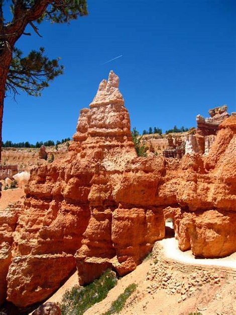
When you reach the bottom, take a brief detour to see the hoodoo that looks like Queen Victoria in the Queen’s Garden. The trail connects with the popular Navajo Loop as you head up the canyon. The final section includes a pair of trails.
They are Wall Street and Two Bridges. The former is the most popular. Both lead to Sunset Point via switchbacks. If you parked at Sunrise Point, take the Rim Trail to your vehicle.
2. The Sunset Point To Sunrise Point Hike
This easy paved walking trail is part of the larger Rim Trail. This one-mile, out-and-back walk leads along the top of Bryce Canyon and overlooks the amphitheater and the hoodoos. It also provides you with great photo opportunities for little time and comparatively little effort.
Experts say that on a clear day, you’ll even be able to see Navajo Mountain which is 80 miles away. Indeed, from this tiny trail, you will also see portions of the previously mentioned Queen’s Garden trail as it meanders ‘long the ridges to the left, and the numerous Navajo Loop Trail switchbacks to the right.
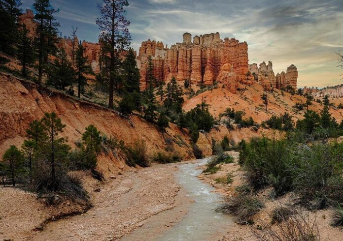
3. The Fairyland Loop Hike
Want a longer hike? This one is a total of eight miles. The elevation gain is almost 2,300 feet. It’s rated “strenuous” due to the elevation and distance.
You can begin the trek from either Fairyland or Sunrise Point but starting at the latter will add more distance. You could also take a quick detour to Tower Bridge, although it could also serve as a separate hike. The Fairyland Loop will take you along ridges and through hoodoos where you’ll enjoy awesome views and close looks at fantastic formations. The cream, gold, orange, and pink tints are quite vibrant on this trail.
4. The Peek-A-Boo Loop Trail
If the Navajo and Queen’s Garden Trails are too busy for you, this five-and-a-half-mile trail might work for you. There’s an elevation gain here of over 1,500 feet. Since most of it occurs rather quickly, the hike is rated strenuous.
Here you steeply descend into the striking Bryce Canyon Amphitheater, hike through huge hoodoos, and more. Be sure to see the Wall of Windows, where the arches and various cracks in the upper sections of the joining hoodoos frame the sky behind it.
You can do this hike with the previously mentioned Queen’s Garden/Navajo Loop. It’s a trail known as the “Figure 8 Combination Trail.” It’s a double loop hike that’s almost six and a half miles long and covers more of the popular amphitheater.
5. The Queen’s Garden Trail
This easy hike is an out-and-back trail that’s under two miles. It seems like a loop trail though because the views in each different direction are distinctly different. Some travel writers say it is comparable in diversity and beauty
to the well-known Queen’s Garden/Navajo Loop Combination Trail, but it’s “less than half the distance, making it perfect for [travelers who are] short on time.”
You begin at Sunrise Point, hiking along the top of pine-dotted, limestone and mud ridges as you descend into the canyon as the hoodoos rise ‘round you. There are steep drop-offs on at least one side of the ridges, and the trail is only moderately wide. You even pass through artificial arches in a few places.
Relax on one of the benches in the shady patch of pine trees. See the famous hoodoo that looks like Queen Victoria. Return to the parking lot via the same trail.
The well-known Navajo Trail beginning at Sunset Point will lead you through topography similar to that of the Queen’s Garden. You will find towering, multi-colored hoodoos rising up all around you. Hike through the attractive amphitheater, beneath Sunset Point.
The main difference between the pair is that the 1.3-mile Navajo Trail hike has a greater elevation gain, 550 feet, over a series of switchbacks. It is also generally steeper. While the park rates it as a moderately difficult hike, others claim if you hike slowly, it’s easy.
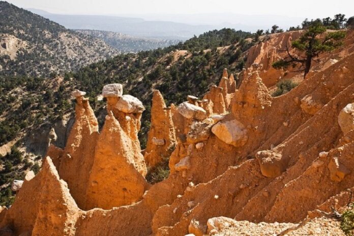
7. The Bristlecone Pines Hike

This one-mile loop trail hike provides you the opportunity to see something you don’t normally see much of in Utah, Bristlecone pine trees. Some of these ancient trees are over 1,800 years old. See the blue spruce, Douglas and white firs, and wildlife too.
This easy hike starts at the scenic drive’s south end in Rainbow Point. While the elevation here in the park climbs to 9,100 feet, the trail has an elevation gain of under 200 feet. Snow does linger here due to cooler temperatures. So don’t plan on completing this hike in the winter or even the early spring.
8. The Tower Bridge Hike
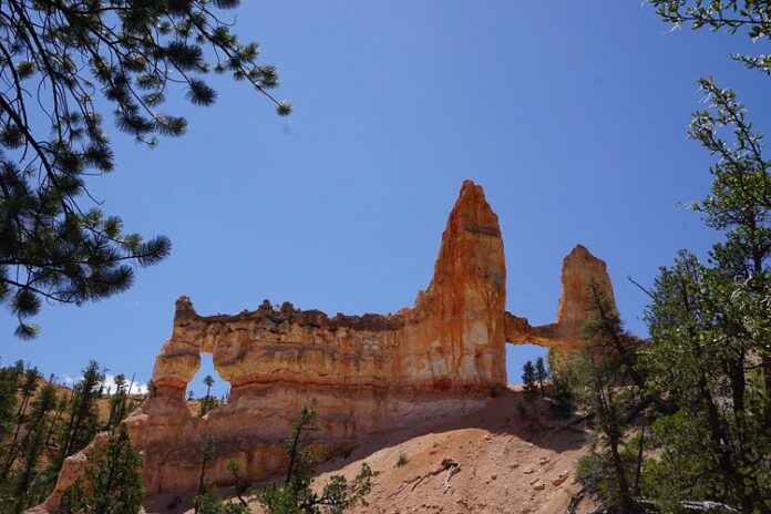
For those interested in Bryce Canyon but not up for hiking the whole Fairyland Loop Trail, there’s always the out-and-back Tower Bridge Hike. It’s less than four miles, has an elevation gain of 800 feet, and is rated only moderately difficult. Here you will hike a part of the famed Fairyland Loop Trail, before detouring onto a spur trail that takes you to the distinct stone structure named the Tower Bridge.
What’s more, you can also see some of those previously mentioned Bristlecone pines as it meanders through high hoodoos and the multi-colored stone wall known as the Chinese Wall. There’s even a bit of welcoming shade not far from the popular Tower Bridge.
9. The Hike To Mossy Cave
Perhaps this less-than-one-mile hike is incorrectly named. While one would expect this out-and-back trek to lead to a cave, those in the know say it might be more accurately described as a damp overhanging natural shelf. At any rate, it is an easy hike with an elevation gain of 300 feet.
The true highlights here are the waterfall and the river that runs through the rugged countryside here at the base of these hoodoo-dotted hills. You’ll hike along the river much of the time, cross a bridge, then hike up to the “mossy cave.” The trail splits as it ascends.
The cave is to the left and the overlook is to the right. Mossy Cave is situated outside of the park gates, on Highway 12, on the way to the town named Tropic. It’s a nice stop on your way to popular Capitol Reef National Park.
10. The Hat Shop Hike
This four-mile in-and-out Bryce Canyon hike is named after the ivory rocks precariously perched atop the towering hoodoos you will see on your journey. If you have actually hiked a number of the more popular trails in this park and are simply seeking a trail that is generally uncrowded, then this is it. Keep in mind though, that this steep hiking trail is also physically challenging.
Your descent into the canyon is a sharp one. Once you hike past the hoodoos and reach the bottom though, you will be amazed when you turn and look skyward. Look up 1,000 feet and note the hike back out that awaits you. Be sure not to miss the views of the Kaiparowits Plateau and the Paria River Valley too.
11. The Sheep Creek And Swamp Canyon Hike
You have hiked most of the top-rated loop hikes in Bryce Canyon National Park. You’ve gazed in awe at all those high hoodoos and now just long for some peace and quiet. If solitude appeals to you, then get ready for the Sheep Creek and Swamp Canyon hike.
This serene route takes you through a quieter place that few tourists even know exists, the Bryce Canyon backcountry. Here is something else unique to this pleasant pilgrimage: You will actually see running water. Running water is a rare sight for most of the hikes in this park.
This particular trail is moderately difficult as it has a distance of over four miles and an elevation change of 800 feet. It is also part of the well-known Under the Rim Trail. Veteran visitors say it is best to hike this trail clockwise.
They also confirm that the best time to see Bryce Canyon is generally from May to September. Sections of the area around the trail have been impacted by relatively recent wildfires, so now in the spring it fairly bursts with colorful wildflowers. Look for wildlife as well, and, as always, my fellow national park perambulators, Happy Trails!