Contents
- 1. Hike to the Lower Calf Creek Falls
- 2Hike to Mesa Arch
- 3Hike to the Golden Cathedral
- 4Hike to Cassidy Arch
- 5Hike the Navajo Loop & Queens Garden Trail
- 6Hike in the Paria Canyon
- 7Hike the Narrows
- 8Hike the Red Cliffs Recreation Nature Trail
- 9Hike to Double Arch
- 10Hike in Horseshoe Canyon
- 11Hike to the Broken Bow Arch
- 12Hike Bryce Canyon’s Wall Street
- 13Hike to Goblin’s Lair & Carmel Canyon
- 14Hike Little Wild Horse Canyon & Bell Canyon Loop
- 15Hike the West & East Rim Loop at Dead Horse Point
- 16Hike the Loop Trail at Natural Bridges National Monument
- 17Hike the Riggs Spring Loop
- 18Hike the Zion Subway, Bottom-Up
- 19Hike Angel’s Landing at Night
- 20The Observation Point Hike
- 21Hike Grandstaff Canyon
- 22Hike to Navajo Arch
- 23Hike Druid Arch
- 24Hike Sulphur Creek
- 25Hike to the Timber Creek Overlook


If you’re headed for the US state of Utah, and into hiking, then read on, fellow traveler. The Utah desert is admittedly hot but that will just add to your retelling of the adventurous vacation tale when you arrive home. Mind you, if you hike in the fall, it’s cooler and less crowded, and hotel rooms are cheaper. The choice is up to you. However, in order to help you with choosing which road to travel, so to speak, here are the 25 must-do hikes in Southern Utah.
The 25 Must-Do Hikes in Southern Utah
1. Hike to the Lower Calf Creek Falls

This hike to Lower Calf Creek Falls is an out-and-back hike of 5.74 miles with an elevation gain of 515 feet. Your trek begins at the popular Calf Creek Campground in Boulder. Outhouses and potable water are available here. The hike through the sandstone canyon and beyond includes Native American ruins, a beautiful waterfall, and a wonderful natural pool for swimming.
Eat lunch at the waterfall. The trail’s open all year but it’s hot in summer and there’s sometimes snow in the winter. There is a fee for parking and an additional charge to camp there if you choose to do so. Dogs are permitted if they’re leashed.
2Hike to Mesa Arch

Travel to Moab. For it is here that you can hike to the famous Mesa Arch in Canyonlands National Park. This loop hike is approximately one mile (depending on the source).
It is obviously an easy hike with an elevation gain of 164 feet. Plan on this being a one-hour adventure adding in some time to stop and admire the historic arch. You should be able to go see a few things in Arches National Park on the same day if you wish. In fact, if you plan ahead, you can get a campsite in Devil’s Garden, and you can set up a base there for a relaxing weekend-long vacation.
3Hike to the Golden Cathedral
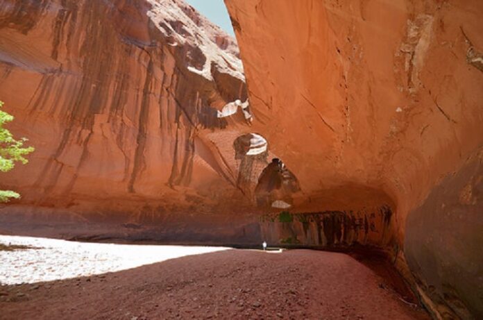

Head to Garfield County and the Egypt Trailhead. For it is here that your trek to the Golden Cathedral deep in the Grand Staircase – Escalante National Monument begins. It is a moderately difficult out-and-back hike with a distance of 9.27 miles and an elevation gain of 1398 feet.
Note that you can either head right for the canyon’s mouth or hike down Fence Canyon and camp out at the Escalante River. Either way, once you reach Neon Canyon, it’s just a short hike to the Golden Cathedral. It should take you well under one hour. Dogs are permitted here but they must be on a leash at all times.
4Hike to Cassidy Arch


Torrey is the site for this scenic out-and-back adventure. The total distance is just over three miles. The elevation gain is 1,283 feet. While it’s often said that the lengthy, more demanding hikes are worth the effort, this trip provides a stunning payoff as you stand atop the arch following a short hike with but a minimal amount of scrambling.
You can also explore the awesome overlooks of popular Capitol Reef National Park, and if you’re a shutterbug, get some great shots of the cool rock formations and the striking dark night sky here. The Fruita Campground is available if you choose to do some camping while you’re there as well.


This hiking trip is based in Bryce. Depending on your choices, you’ll hike a distance of between 2.93 and three and a half miles. The elevation gain here is 679 feet.
No matter which trail you use to see the famous hoodoos in Bryce Canyon, this loop hike is said to be one of the very best ways to do it. The Navajo trail which actually starts at popular Sunset Point includes a lot of switchbacks but gets you to the bottom in a comparatively short time. It’s well-traveled so while you won’t be alone, it confirms our recommendation. Don’t hike here in the winter unless you like snow.
6Hike in the Paria Canyon
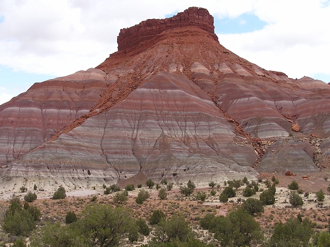

Avoid the crowds here in Kanab. This hike is a total of almost 15 miles out and back with an elevation gain of 846 feet. Want to save money on this fairly unknown canyon hike as well?
This is a great way to see Zion National Park’s Narrows, Antelope Canyon’s steep walls, or the oddly-patterned lines of the well-known Wave, and avoid spending $100.00 on a commercial hour-long tour. You can get all that in less-popular Paria Canyon for free. Enjoy camping?
Check out the relatively unpopulated campsite at the trailhead. It’s just five dollars per night. (Note: you’ll get your feet wet on this hike and there’s little shade. Plan accordingly.)
7Hike the Narrows
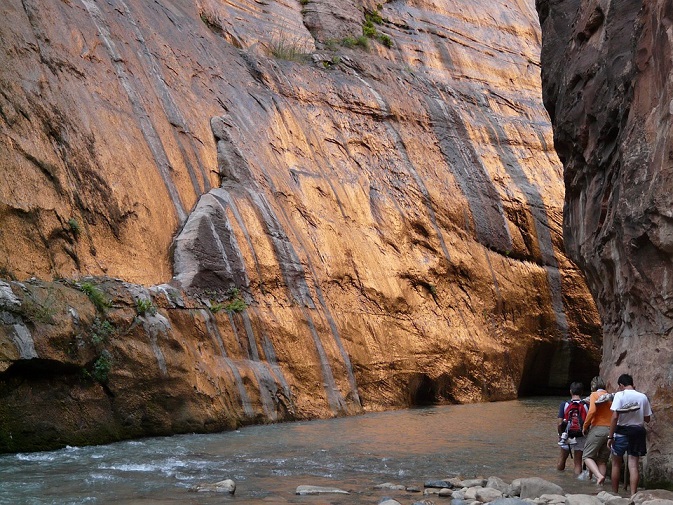

Some travel scribes say hiking the famous Narrows in Zion National Park in Springdale is “one of the most unique” adventures you may ever experience. It is under 10 miles out and back with an elevation of 330 feet. What may make it somewhat difficult for some is that much of the trail could be submerged by the Virgin River which makes it refreshing in the hot summer but possibly too cold in the fall. Still, the bottom of this slot canyon is highlighted with trees, waterfalls, natural springs, wildlife, and incredibly colorful sandstone walls. The Narrows is closed when the river is flowing at 150 CFS (Cubic Feet per Second) or more.
8Hike the Red Cliffs Recreation Nature Trail


This Red Cliffs hike in Hurricane allows you to explore an exceptional area in Southern Utah. It’s also one of the best family-friendly hikes in the state. This out-and-back hike is less than one and a half miles in total and has a comparatively mild elevation gain of 266 feet.
You start at the Red Cliffs Campground north of St. George. Here you trek along blue-water streams running through the red sandstone and pass a few small waterfalls. It provides an eye-catching contrast. There are footholds and a rope where the trail gets a little steep but nothing difficult. There are charges for parking and camping, of course.
9Hike to Double Arch


Travel to the Castle Valley area and prepare for this brief hike. It is a good half-mile out and back with an elevation gain of just 135 feet. This hike in the Arches National Park vicinity will allow you not only to see the Double Arch in person but it gives you the choice of visiting other natural arches as well. The famous Double Arch is actually a pair of arches that share the same rugged stone for their outer leg foundation. This natural attraction is the result of downward water erosion. Unlike some of the other previously mentioned hiking trailheads, you should have no trouble finding parking here.
10Hike in Horseshoe Canyon
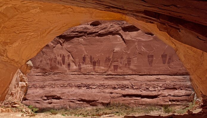

Scraping into the top ten list of our 25 must-do hikes in sunny Southern Utah is a healthy hike in popular Horseshoe Canyon. This is an out-and-back hike near Hanksville, in Wayne County. The total distance is reportedly 7.02 miles.
There is a somewhat significant elevation gain of 1,857 feet. If you enjoy pretty scenery you will not be disappointed on this hike. The Horseshoe Canyon Trail allows you to see various local flora. Veteran visitors report there are some beautiful wildflowers found there.
11Hike to the Broken Bow Arch
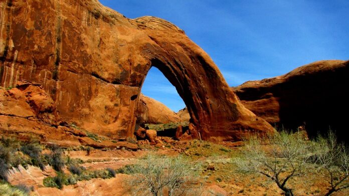

Next on our list of Southern Utah hikes is the Kane County-centered Southern Utah hike to Broken Bow Arch. This is a hike of 6.28 miles out and back. It includes an elevation of 732 feet.
The arch was named by an early explorer here who discovered pieces of a broken Indigenous bow at the arch. The hike to this huge sandstone arch located in Grand Staircase-Escalante National Monument begins at the Willow Gulch Trailhead off of Hole in the Rock Road. Most of this hike takes place in a striking sandstone canyon. You’ll probably find comparatively few other people hiking here. Dogs are permitted but must be on a leash.
12Hike Bryce Canyon’s Wall Street


Bryce’s Bryce Canyon is a popular place for several hikes. This loop trail hike will take you on a short trip of 3.25 miles. The elevation gain is just 610 feet. Yes, this easy hike features noteworthy natural land formations and stunning views.
But the main attraction here is the famous hoodoos. What are hoodoos? Hoodoos are Bryce Canyon’s incredible rock formations.
Veteran visitors suggest getting there before winter begins. You can start this hike at either end, too. Start at the Queen’s Garden Trail by Sunrise Point or at Sunset Point by the famous, majestic Wall Street. Empire of the Sun’s “Alive” music video was shot here.
13Hike to Goblin’s Lair & Carmel Canyon
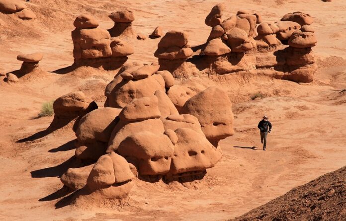

Green River is the place to be for this must-do, out-and-back hike in Southern Utah. The full distance is under three and a half miles with a minimal elevation of 433 feet. This is a comparatively secluded hike.
This trek is terrific since it offers ample opportunity for shutterbugs. It’s also reported to be a super spot for beginner canyoneers. They can explore here without fear.
This awesome, isolated hike allows for some flexibility and choices in route as well since there aren’t a lot of places in Goblin Valley that are off-limits. (“Goblins”, in this case, are unusual rock formations.) Rather than follow some predetermined route you find online, customize your adventure!
14Hike Little Wild Horse Canyon & Bell Canyon Loop


While in Green River, consider completing this loop hike too. This loop hike has a distance of over eight miles and an elevation gain of under 800 feet. Those in the know suggest giving yourself at least five hours so that you can enjoy the easily accessible and striking slot canyons here.
Some travel writers say that Little Wild Horse Canyon is the better of the two canyons on what some call a “classic Southern Utah experience.” If you are not feeling so athletic and choose to hike only one of the two canyons, go for Little Wild Horse. It’s pretty easy and there are no surprises. Camp nearby and save one for the next day!
15Hike the West & East Rim Loop at Dead Horse Point
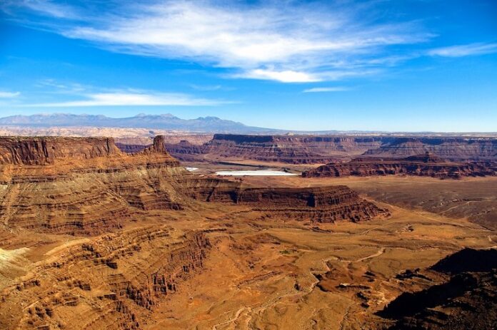

Have you ever noticed how much there is to do in and around Moab? This loop trail hike is yet another recommended activity. The total distance here hiking the “Grand Canyon” of Utah is a good five miles and the elevation gain is 928 feet.
Mind you, experienced hikers suggest that if you’re up to a hike of almost ten miles, you should choose to extend the hike by adding the various lookout points. If, however, you’re interested in the lookout points but not feeling energetic, you can cut out the portion where the East and West rims of the trail meet. It’s a tad touristy anyway.
16Hike the Loop Trail at Natural Bridges National Monument
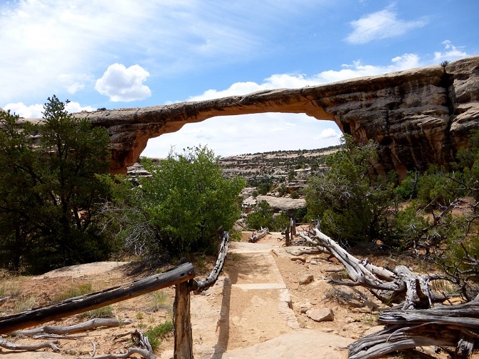

Slotting in next on our list of must-do hikes in Southern Utah is this loop trail trek to this well-known U.S. National Monument situated roughly 50 miles northwest of the famous Four Corners boundary of the southeast part of the state. While hiking around this area can take anywhere between a mere matter of minutes or an entire day, this hike has an entire distance of almost nine miles. It is a moderately difficult hike with an elevation gain of 560 feet. This is yet another hike that can be done from either end. It’s just a matter of personal preference.
17Hike the Riggs Spring Loop
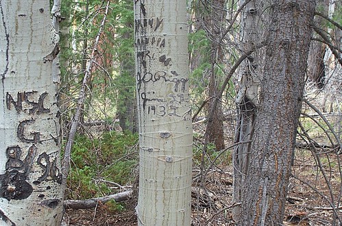

If you’re spending some time in Bryce Canyon, consider completing this hike as well. Indeed, this is a great place to not only hike but to do some backcountry camping too. This loop trail hike in one of the nation’s most scenic national parks is almost nine months.
It has an elevation gain of 2,044 feet. The views here in Bryce Canyon National Park are nigh-unparalleled and also offer exceptional opportunities for noteworthy nighttime photography. Hiking the rugged Riggs Spring Loop allows you to escape the crowds. The preferred trailhead is at the Rainbow Point overlook. Enjoy seeing the superb sight of the sun setting on the signature pink cliffs!
18Hike the Zion Subway, Bottom-Up
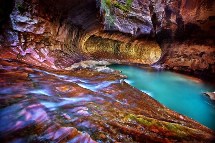

This out-and-back Utah adventure begins at the lesser-known Left Fork Trailhead located on Kolob Terrace Road near the little town of Virgin outside of popular Zion National Park. The hike requires a permit and has a total distance of almost seven miles. More importantly, it leads you to one of the park’s most beautiful attractions, The Subway.
You can cool off and even go swimming in the pools located above the well-known Subway. Dress appropriately too as a great portion of this hike will take you through the Virgin River. Be sure to wander off the trail for a little bit to check out the dinosaur tracks and the cascading water as well too!
19Hike Angel’s Landing at Night
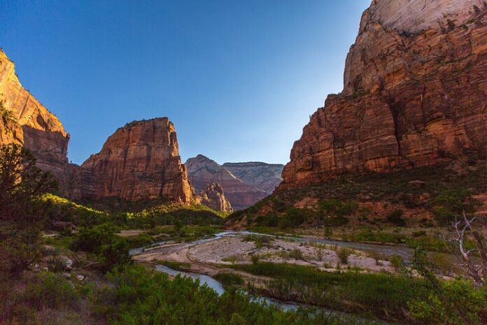
If you’re vacationing in Zion National Park, this is an exceptional nighttime activity! This is an out-and-back hike with a total distance of under five miles. The elevation gain here is 1,512 feet.
This is one of the park’s most popular hikes. Zion offers amazing night views of the canyon to those with no fear of the dark. It makes a great day hike too but nighttime is a great time to see the place with headlamps.
Indeed, Angel’s Landing is even more breathtaking once the sun goes down. Park at or near the Grotto. The trailhead for this hike is across the river, to the right, and uncrowded at night.
20The Observation Point Hike
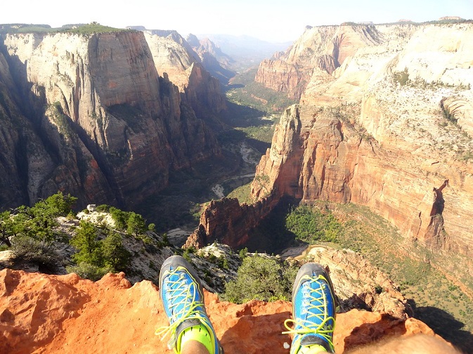

Enjoy another adventure in Springdale by taking this approximately seven-mile out-and-back hike. It has an elevation gain of 2,100 feet and offers an excellent view of all of Zion Canyon. Veteran visitors say you can beat the tourist crowds and look down on awesome Angels Landing.
Indeed, not only is it a great place to take pictures but it’s a nice shady spot for lunch as well. The ascent is a bit strenuous but great exercise. You can drive your vehicle right to the trailhead in the winter and avoid crowds. In the summer, you’re better off taking the Zion Shuttle from the visitor center. Don’t miss the Weeping Wall either.
21Hike Grandstaff Canyon
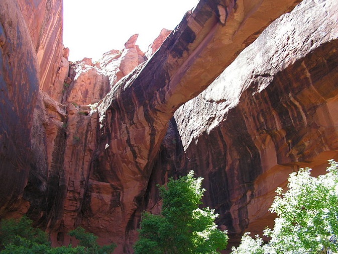
More must-do hiking awaits you in Moab. This is another out-and-back hike with a distance of 4.34 miles and an elevation gain of 1,335 feet. Avoid the crowds at Arches National Park, and take in incredible views of the nation’s largest natural bridges.
History buffs may take a special interest in this place. Up until the 1960s, it was called N*gger Bill Canyon. The name was changed to Negro Bill Canyon until it was renamed Grandstaff in 2017. Regardless of its initial lack of a politically correct title, this canyon, nestled along the mighty Colorado River, has always been a favorite. Be prepared to get wet and don’t miss Morning Glory Bridge!
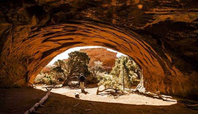

While in Moab, don’t miss your chance to take this out-and-back hike either. It is actually less than three miles and has an elevation gain of just 377 feet. Give yourself between two to four hours for this hike. You will find some shade, and other hiking trailheads, and see multiple arches and rugged red sandstone rock formations on your way to Navajo Arch.
Much of this hike is considered easy until you get past Landscape Arch. At that point, you will need to carefully climb and scramble up some slickrock fins. Navajo Arch is actually surrounded by trees. In fact, there’s even a sturdy single pine tree growing right beneath the famous arch.
23Hike Druid Arch
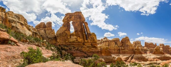
Journey to Monticello, Utah for this must-do hike. It is over 10 miles out and back with an elevation gain of 1,594 feet. You will need between six and eight hours for this hike so pack a lunch!
Before heading out for Druid Arch, named for its resemblance to England’s Stonehenge, on Canyonlands National Park’s eastern side, you should drop by the Needles Visitor Center and get a map. The trek begins at the Elephant Hill Trailhead. Start your hike around 5:30 a.m. since the morning’s the best time to see the famous arch. This hike includes amazing views of the cliffs and canyon, It involves some scrambling and climbing too.
24Hike Sulphur Creek
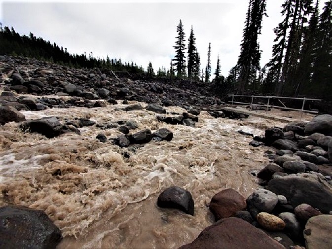

Travel to Torrey to take this nearly six-mile point-to-point hike. It includes an elevation gain of 1,191 feet. This is one of the most popular backcountry hikes in Capitol Reef National Park. It also serves as a superb introduction to canyoneering. It features a trio of wonderful waterfalls and stunning steep cliff walls as well.
This point-to-point hike begins at the Chimney Rock Trailhead and requires that you either hike three miles along Highway 24 or set up a shuttle ride. If you decide to do this hike in the summer, you may wish to hike through the river to keep cool. The hike officially ends at the Capitol Reef National Park Visitors Center.
25Hike to the Timber Creek Overlook
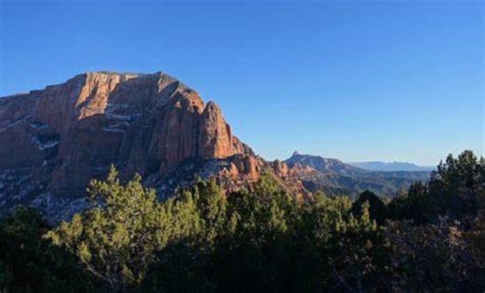

This is a short out-and-back hike in New Harmony, Utah of just over one mile. It has an elevation of 102 feet and provides you with a great panoramic view. It is family-friendly and fine for hikers of all skill levels too.
You will find the Timber Creek Overlook trail at the end of Kolob Canyon Drive in popular Zion National Park. The trail is well-maintained. It includes restrooms and picnic tables as well. Veteran visitors suggest doing the hike a little bit before sunset as the glow of the sunset on Kolob Canyon’s rugged sandstone walls is incredible. Oddly, travel writers report that this overall area is actually one of the park’s “least explored parts.”
