Upper Falls was the other major waterfall that we saw on the Yellowstone River.
We thought it tended to be overshadowed by the Lower Falls further downstream because it wasn’t plunging within the depths of the Grand Canyon of the Yellowstone River.
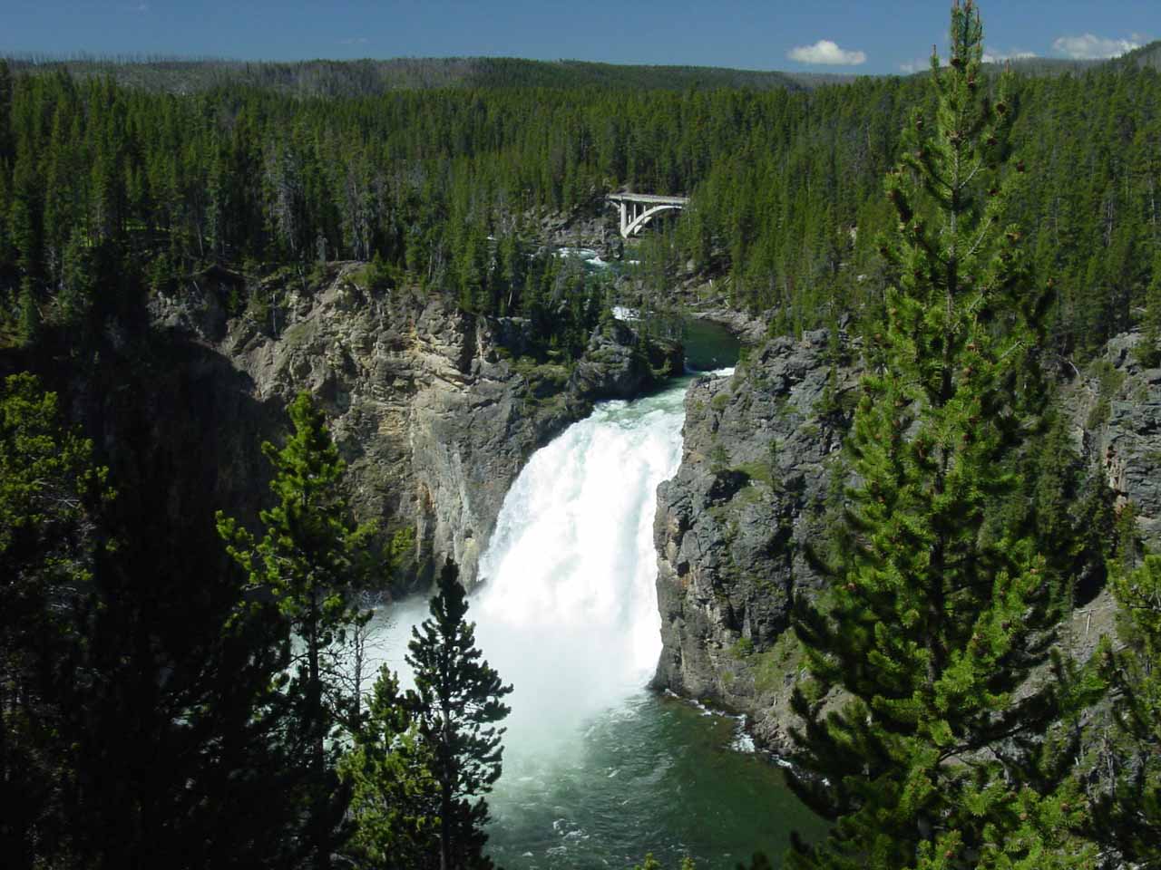
Upper Falls of the Yellowstone River
Nonetheless, this impressive 110ft waterfall held its own in terms of scenic allure, especially when we considered its power.
In fact, I’d bet there would be an entire state park or reserve devoted to just this waterfall had it been on its own outside the Yellowstone National Park boundaries.
To our knowledge, I don’t think it was possible to get down to the river level to see the falls at its base (or at least not possible from the obvious lookouts and trails sanctioned by the Park Service).
We’ve managed to experience this waterfall in a three different ways, which we’ll get into below…
Experiencing Upper Falls – view from Uncle Tom’s Point
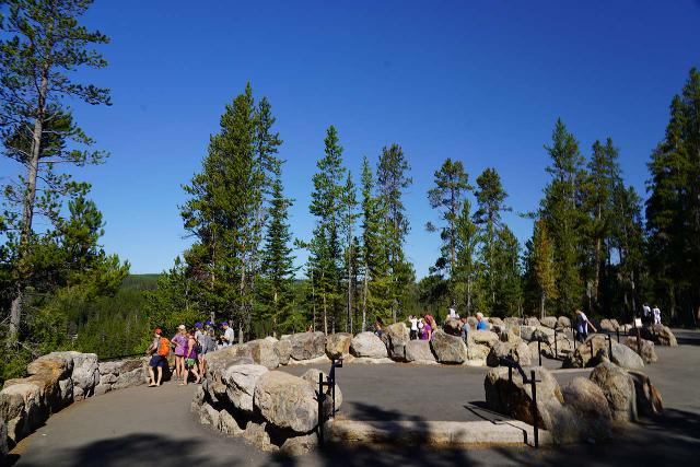
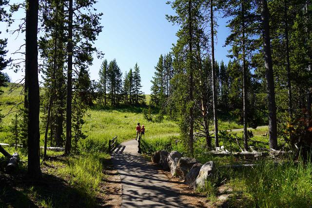
The viewpoint near the Uncle Tom’s Trailhead and Lookout (also known as Uncle Tom’s Point) gave us the classic view of Upper Falls, which was just a few paces from the parking lot for the Uncle Tom’s Trail.
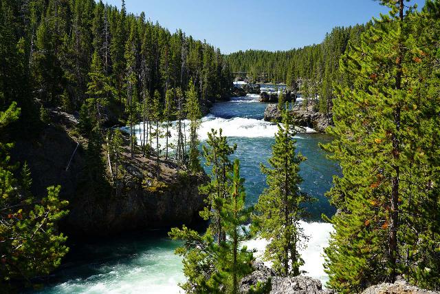
From the Canyon Junction, we drove south past the Chittenden Bridge (which was that bridge you see in the photo above that was upstream of the falls), and then we turned left onto the South Rim Drive.
After about 0.6 miles on the South Rim Drive, we reached the parking lot.
Once we parked the car, we headed towards the western end of the lot, and that was when we saw a trail that continued west and provided the frontal view of the Upper Falls.
Experiencing Upper Falls – profile view from opposite side of the brink
While the Uncle Tom’s Lookout mentioned above yielded the classic view of Upper Falls, the South Rim Trail continued another 0.3 miles upstream along the Yellowstone River to a lesser-visited overlook.
During this walk, the paved walkway continued alongside the river though the views were blocked by trees.
However, after making one last curve gently downhill (lots of people opted to bypass this curve and take an unsanctioned shortcut), we then arrived at the overlook, which gave us an unusual profile view of the Upper Falls.
On the morning of our visit in early August 2020 at around 10am, we managed to see a double rainbow in the blasting mist at the base of the falls.
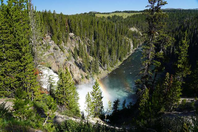
Compared to the main lookouts at Uncle Tom’s Point, this spot was much quieter largely because most people don’t bother exploring the South Rim Trail in this direction.
But it’s not completely unknown because there would always be a handful of people showing up in between stretches of having this spot to ourselves.
Experiencing Upper Falls – view from the brink
As the name implied, this way of experiencing Upper Falls pretty much involved getting right up to the edge of the powerful waterfall.
From the nearest parking area, we walked a mere 450ft to the upper lookouts as well as steps.
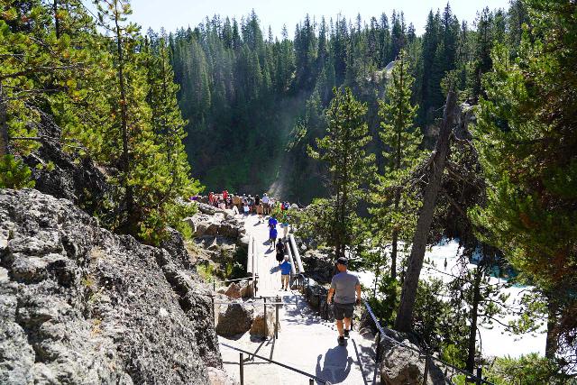
Then, as we descended the steps, we could start to appreciate some of the intermediate waterfalls on the Yellowstone River rapidly tumbling towards the brink of the Upper Falls.
The foot path then proceeded another 100ft or so to the very busy lookout right next to main drop of the Upper Falls.
From there, we could appreciate the waterfall’s power as well as try to make feeble attempts at conveying that power in our awkward photos.
It was hard to maintain social distancing at this overlook given how popular it was, but it seemed that most people don’t linger here for long.
The parking lot for the Brink of the Upper Falls was at the end of the well-signed turnoff 1.7 miles south of the Canyon Junction along the Grand Loop Road near Canyon Village.
This well-signed turnoff was between the Chittenden Bridge and the entrance to the one-way North Rim Road that loops back to Canyon Village.